
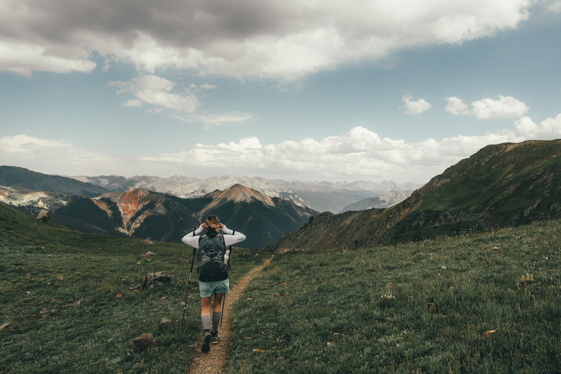
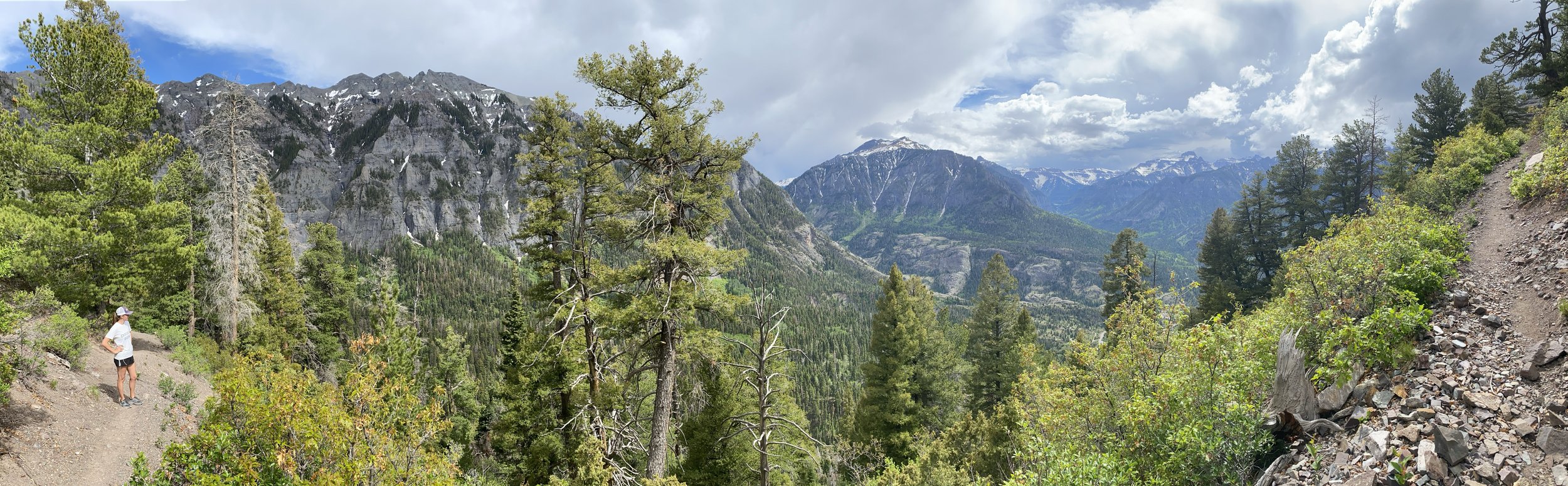
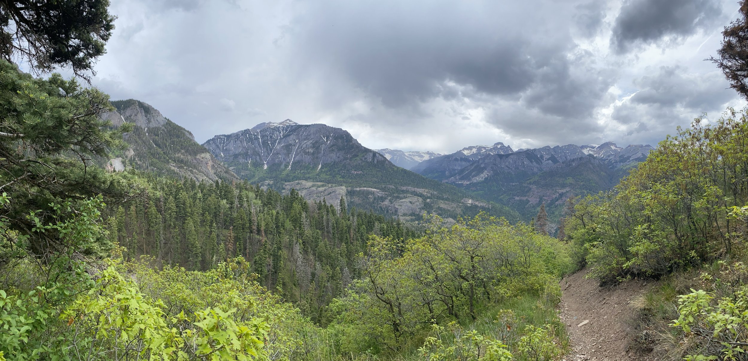
Hiking around Ouray is like hiking in a postcard. Whether you call it hiking, trekking, going on a walkabout or rambling, putting your feet into motion and heading into the hills is a wonderful way to experience Ouray. Many of the trails listed below begin in the foothills around town. All of these trails provide you with postcard perfect backdrops and awe-inspiring views.
Hiking in ouray
Be sure to look down and around you on the trails. Identifying diverse species of plant and animal life and geologic treasures along the trail is a worthwhile pastime. There is nothing quite like discovering tiny tundra blossoms clinging to the bottom of a rock or unearthing a quartz crystal or even gold in quartz in the tailings of an old mine.
Download maps or apps!

DIGITAL PERIMETER TRAIL MAP

Ouray County & Uncompahgre DIGITAL TRAIL MAP

CO Trex app (APPLE)

CO Trex ApP (Google)
Another option would is the All Trails app or website.
Hike Ouray Right
Hiking Facts and Hints to Make Your Journey Pleasant
1. Moderate hiking with stops for rests and taking in scenery, uphill, covers approximately 1000 vertical feet an hour. Downhill is usually about 1300 feet.
2. Average distance covered in moderate hiking is about 1 to 1.5 miles uphill and 2 miles downhill.
3. The tree line varies between 11,200 feet and 11,800 feet. Average is about 11,500 feet.
4. Above tree line is tundra, patches of scrub willow and rocks and cliffs with scree and talus.
5. At the first sound of thunder, all parties should descend below tree line. Do not shelter under a solitary tree. If caught above tree line, when lightening strikes, try to find an indentation in the ground or hide under a rock. Detach yourself from your pack and anything metal. Crouch on all fours.
6. Wild flowers start in May but the finest displays are from mid July to mid August. The best elevation for wild flowers is between 11,800 feet and 12,500 feet.
7. The "monsoon" can run from early July to the end of August. Generally this can involve moderate to
heavy rain after about 2 pm.
8. Temperature falls about 3 degrees for every one thousand feet. Example: 75 degrees in Ouray at 7,600 feet becomes 58 degrees at 12,800 feet. If Ouray's temperature falls to 60 degrees, it can be 42 degrees on the top of Sneffels. This is without a wind-chill factor. If there is a 35MPH wind on the top of Sneffels or any highline ridge, the effect can be well below freezing.
9. Any hiking outing, especially with one individual, should involve leaving details of timings and hike destination with another party.
10. All hikers doing more serious hikes should purchase a mountain rescue safety card from Ouray Mountain Sports or other outlets.
11. The best "big picture" map is the Drake Mountain Map of Silverton, Telluride and Ouray. The best local map is the Hiking Trails of Ouray County put out by the Ouray Trails Group. For specific detail, the best smaller-scale maps are the USGS topographical series. The most used quadrants for our hiking are Ouray, Ironton, Mt Sneffels, Telluride, Ophir, Handies Peak and Silverton.
12. The water on trails is not suitable for drinking. Several of the most popular trails have no water at all on them. (Think of dogs!)
13. Many trails can be very slippery, especially if footwear is not adequate.
14. Cell phones often do not work, even on the top of ridges and mountains.
15. Always carry adequate clothing, good footwear, sunscreen, insect repellant, energy bars, and water.
16. Many trails pass through private property. Please be responsible. Pick up trash. Do not haul out mining remains. Respect owner's rights. There will probably be no "private" signs.
17. Best advice is to start early. It is cooler, the light is better and you will be off the top before weather deteriorates.
18. If doing anything other than one of the most used trails, take map(s) and trail guide. This will help avoid getting lost and wasting time!
19. Do not "use bathroom" close to water source.
20. If in a group, keep together. Communicate. Watch for signs of altitude sickness. Descend immediately if you notice hypothermia, irritability, nausea, spots before the eyes or other abnormal signs of weakness. Drink plenty.
Colorado outdoor search & rescue Card (COSAR)
Are you backcountry ready? Help us help you.
Each year, Colorado Search and Rescue teams perform over a thousand missions helping those who get caught in emergency situations in the backcountry. No one knows when they may need help. Prepare for the unexpected
Purchase the card:
$3 for 1 year | $12 for 5 years
Where Can I Buy?
Ouray Mountain Sports
Ridgeway State Park
What Is Covered? Costs incurred by search and rescue teams authorized by local sheriffs.
Equipment
Aircraft
Dogs
Mileage
Horses
Watercraft
Snowmobiles
Meals
What Is Not Covered?
Fund does not pay individuals
Fund does not pay victim medial expenses
Who Needs It? Those who use, or plan to use, Colorado’s backcountry
Hikers
Mountain Bikers
Equestrians
Campers
Kayakers
Climbers
Cross Country Skiers
Photographers
Why Buy It?
To cover search and rescue mission costs
Support Colorado search and rescue volunteers
To contribute to well trained and equipped search and rescue teams
For more information:
Colorado Department of Local Affairs
970.248.7310
The infamous Perimeter Trail
-
5.8 Miles
-
Give yourself a minimum of 4 hours to do the whole trail.
-
Moderate | There are different types of terrain. Be prepared for some steep inclines, loose gravel in spots, and moderate elevation gains/loss.
-
Dogs are absolutely allowed! Please remember to pick up after them.
Enjoy panoramic views of the entire city of Ouray. The Perimeter Trail loops you around the city and takes you past Cascade Falls, views of Mount Abrams, access to the Via Ferrata in the Uncompahgre Valley, across the high-bridge above Box Cañon Falls, through a tunnel, and endless photographic points.
Easy Hikes
Sometimes, even if you are an avid hiker, it is good to get used to the elevation by doing shorter easier hikes. Take a look at a couple of options.
-
If you are looking for a very short hike with views of a waterfall this is for you! You can get to the parking lot on 8th Avenue and only have a .5 mile walk to the spectacular Cascade Waterfalls.
-
.6 Miles one-way
-
30 Minutes
-
This is a very easy hike
Elevation gain 200 feet
-
Dogs are absolutely allowed! Please remember to pick up after them.
Cascade Falls
Ironton Townsite
-
You can find this hike south of Ouray off of Highway 550 (Red Mountain Pass). Once you leave town, it is 8 miles and there will be a sign that says “Ironton.” This is a leisure hike that has great history. Along this route, you will find our Colorado Boy Mine Ghost Town. You are more than welcome to explore the buildings and take lots of pictures! This trail also stays groomed from cross country skiing in the winter.
-
1 Mile
-
1 Hour
-
Easy
-
Dogs are absolutely allowed! Please remember to pick up after them.
River walk trail
-
The River Walk Trail is an easy stroll on a loop that follows the Uncompahgre River. There are interpretive signs along the trail that dives into the geology and mining history of the area. This is perfect is you are looking to get out and stretch your legs, but are not looking for elevation gain. Pets love this trail too!
-
2.2 Miles
-
1 Hour
-
Easy
-
Dogs are absolutely allowed! Please remember to pick up after them.
Baby Bathtubs
-
This is a great hike to do if you have kids. This trail follows Portland Creek and will have creek crossings. If it is a hot day and you, your kids, or dogs are looking for a spot to cool off, this is the perfect place. The small bathtubs carved into the rocks by erosion are very evident.
-
0.6 Miles
-
30 Minutes to 1 Hour
-
Easy
-
Dogs are absolutely allowed! Please remember to pick up after them.
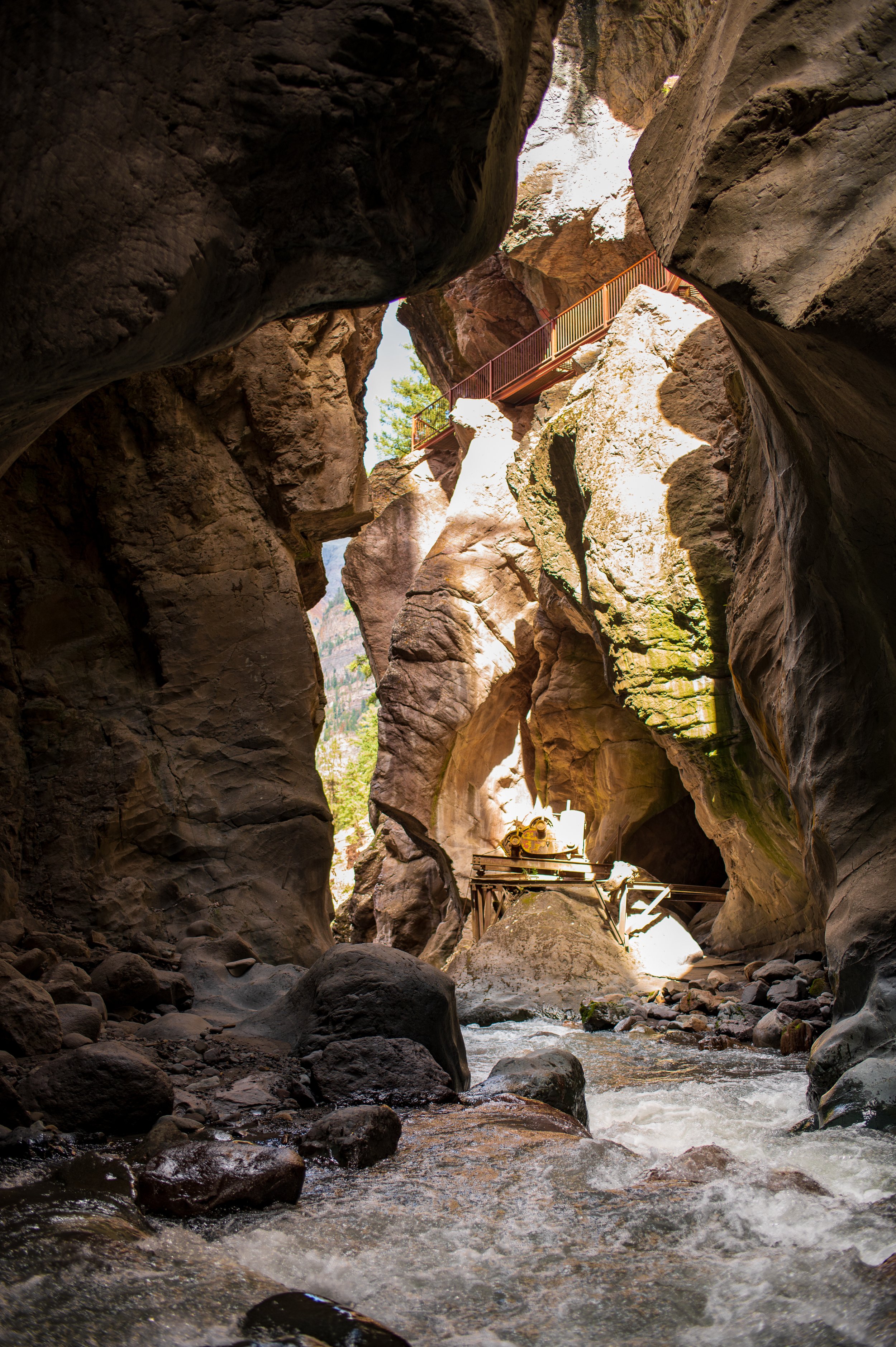
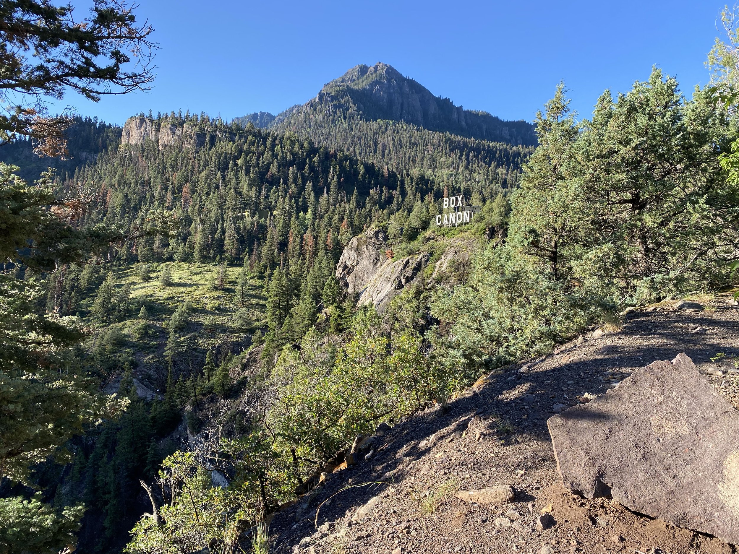
Box Cañon Falls Trail
-
If you haven’t seen Box Cañon Falls, consider it a must. The entrance is two blocks up hill at the west end of Third Ave. During the summer months there is a small fee to see the falls, but it is worth twice what they charge.
After you’ve been into the canyon and seen the falls itself, you have the option of climbing a series of stairs and then following a 1/4 mile trail to a bridge far above the canyon, the views are spectacular.
-
500 feet - Box Cañon
.25 miles to high bridge
-
5 minutes to Box Cañon
15 minutes to high bridge
-
Easy - Box Cañon
Moderate - High Bridge
-
No dogs allowed in Box Cañon
Photo by @TravelingBitners
Ice Park Trail
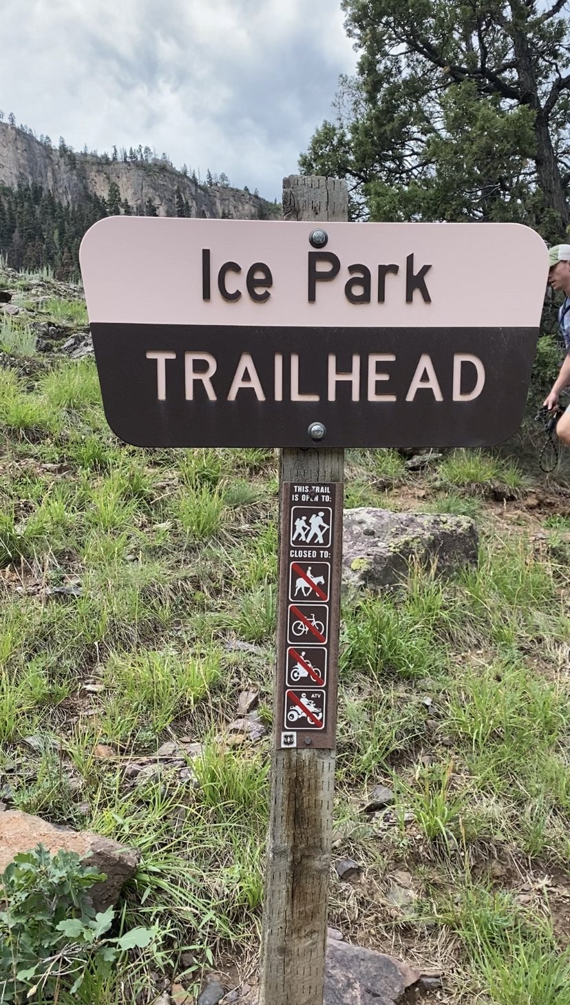
-
This is a slightly longer hike than the two previously mentioned but is easy and one which children enjoy.
The trailhead starts a short distance up the dirt road just after you turn onto the Amphitheater Campground road. Park your car at the base of this dirt road and hike to the trailhead.
The trail follows Portland Creek that meanders through the basin above the Amphitheater. This trail tours beautiful, rolling basin, and gains only 900 feet along its various ups and downs. The trail ends in the campground. From there, walk downhill on the paved campground road to your car.
-
3.8 Miles
-
3 Hours
-
Easy
-
Dogs are absolutely allowed! Please remember to pick up after them.
Portland Trail
-
The Uncompahgre River flows into Ouray from Poughkeepsie Gulch, joining Red Mountain Creek along the way. Over millions of years, these streams have created a magnificent gorge that parallels Hwy 550 into Ouray.
The Ice Park trailhead is located just after you turn onto the Camp Bird Mine Rd. You will find the trailhead market just beyond the CDOT maintenance yard. There will be a sign to point you uphill.
-
1.9 Miles
-
1 hour
-
Moderate
-
Yes dogs are allowed, please pick up after them.
Moderate Hikes
Moderate hikes vary in length, but it includes more steep grades or technical walking routes.
Old twin peaks trail
-
This is a short, but very steep, hike. The resulting views, however, make it all worthwhile.
From Oak Street on the west side of town, walk straight up Queen Street; the road curves slightly to the right as you pass the log home on your left. The trail takes off to the right just after a gate. Stop at the overlook and return or you can continue further on this extremely difficult hiking adventure.
-
.6 Miles one-way
-
30 Minutes
-
This is a very easy hike
Elevation gain 200 feet
-
Dogs are absolutely allowed! Please remember to pick up after them.
Upper Cascade Falls/ Chief Ouray Mine
-
Chief Ouray Mine and its metal buildings are the ones you can see high up in the Amphitheater from the center of Ouray. The actual buildings are just across from a falls section of Upper Cascade Creek.
The Amphitheater is littered with wonderful trails and there are several options for getting to Chief Ouray Mine. One is from the top of Amphitheater Campground. Another is to start from the lower Cascade Falls at 5th Ave. Yet, another is to start out on the Portland Mine Trail and branch left at two different stages to link up with the Upper Cascade Trail.
Although not the longest of trails, this hard slog can be very hot in the summer and is steep in places that has no water at all until the very top and some people find the downhill difficult. Nevertheless it is a classic and surely one to try while in Ouray.
-
5.5 Miles
-
3 Hours
-
Moderate
-
Dogs are absolutely allowed! Please remember to pick up after them.
-
The first mile of these trails climbs through aspen groves and open meadows. The views of Mt. Hayden are beautiful. You will see waterfalls, verdant alpine meadows, shoulder-high flowers and canyon walls of gray volcanic rock, contorted convoluted and eroded by the incredible forces of nature.
For the Alpine Mine, the trail splits after 1.3 miles, you will fork to the right and climb another 2.3 miles.
Extreme care must be taken to prevent falls along some of the steep, sandy slopes high above Weehawken Creek.
-
7.4 Miles
-
6 Hours
-
Moderate
-
Dogs are absolutely allowed! Please remember to pick up after them.
Weehawken/ alpine mine
-
This trail has been carved out of the rock face. This trail is for the sure-footed only and certainly not for small children. There are two mines you can view, Grizzly Bear Mine and Yellow Jacket Mine.
-
2.5 Miles
-
3 hours
-
Moderate
-
Be very cautious if you choose to bring pets or even children. There is very narrow ledges and steep drop-offs.
Sutton Mine Trail
Oak Creek
-
It is a steep beginning to the trail with multiple switchbacks. There are views of old mines, waterfalls, and mountain views.
-
5.8 Miles
-
6 Hours
-
Moderate
-
Yes dogs are allowed, please pick up after them.
-
Very little exposure and lots of shade. The entire route stays below tree line although the last few minutes to the top are open and unobstructed.
-
6.2 Miles
-
5-6 Hours
-
Moderate
-
Dogs are absolutely allowed! Please remember to pick up after them.
Bear Creek
-
This trail does get you up to two magnificent vantage points. The first one is the outstanding view looking back down to Ouray from the south and the second one allows you to see the amazing path of the Bear Creek Trail from across the valley.
There are some steep sections and a couple of rocky “steps” that a young child would need help with. There is no water on the trail.
-
2.6 Miles
-
1.5 Hours
-
Moderate, could be difficult in some spots. Especially after it rains.
-
Dogs are absolutely allowed! Please remember to pick up after them.
Silvershield
-
This trail system offers access to multiple trails such as Baldy Trail, Storm Gulch Trail, Shortcut Trail, Okeson Trail, Cutler Creek Trail, Left Fork Cutler Creek Trail, and Dexter Creek Trail
-
Baldy Trail - 6.4 Miles
Storm Gulch Loop - 5.7 Miles
Okeson - 5.8 Miles
Dexter Creek - 8 Miles
-
Baldy Trail - 5 Hours
Storm Gulch Loop - 4 Hours
Okeson - 6 Hours
Dexter Creek - 4 Hours
-
Moderate
-
Yes dogs are allowed, please pick up after them.
Baldy/ Cutler creek Trails
-
Great hike that gets you back into the wilderness area. There are great views for other mountains, mines, and water features. This is a longer hike, so make sure to schedule yourself all day for this. Bring a lunch and plenty of water.
-
8 Miles
-
8 Hours
-
Moderate
-
Yes dogs are allowed, please pick up after them.
Dexter Creek
Difficult Hikes
These hikes are rated difficult for a reason. They are long, strenuous, technical, and you need to be prepared. Typically these hikes you need to schedule a full day excursion.
Twin Peaks Trail
-
This trail climbs up 2,600 feet in elevation gain to bring you to 10,800 feet in elevation! The trail winds through the forest and is mostly shaded till you come out towards the top. you do get to see a great view of Ouray.
-
7 Miles
-
6 Hours
-
Difficult
-
Dogs are absolutely allowed! Please remember to pick up after them.
-
You will get panoramic views of Ouray, and some 13ers/ 14ers. It is a breathtaking experience. It is a long hike, so be prepared. There is not much shade and is open to grassy meadows at the top.
-
8.4 Miles to Bridge of Heaven
24.5 Miles to Engineer Pass
-
7 Hours to Bridge of Heaven
18 Hours to Engineer Pass
-
Difficult
-
Dogs are absolutely allowed! Please remember to pick up after them.
Horsethief Trail
-
There are a couple of routes you can take to get up Hayden Mountain. Two from Camp Bird Road and two from Ironton. You gain about 3,200 feet in elevation and can be slippery coming down. The peak is 12,578 feet
-
4.4 Miles to the ridge and back
11.2 Miles if you go all the way to Ironton
-
5 Hours for Ridge Route
12 Hours to Ironton
-
Difficult
-
Dogs are absolutely allowed! Please remember to pick up after them.
Hayden Mountain & Loop
-
This trail follows the ridge of the Amphitheater area. There are a few switchbacks when you are ascending/ descending. You may see some big horn sheep along the way, so be sure to keep your distance and appreciate from a far.
-
8.4 Miles
-
8 Hours
-
Difficult
-
Dogs are allowed, be sure to pick up after your pet.
Bridge of Heaven
-
The lower part of the trail climbs up a slight slope, but you are surrounded by the forest. As you continue to climb, you will break treeline because the peak is at 12,678 feet.
-
4.8 Miles
-
5 Hours
-
Difficult
-
Dogs are absolutely allowed! Please remember to pick up after them.
Silvershield
-
It is a steep beginning to the trail with multiple switchbacks. There are views of old mines, waterfalls, and mountain views.
-
5.8 Miles
-
6 Hours
-
Moderate
-
Yes dogs are allowed, please pick up after them.
Richmond Trail
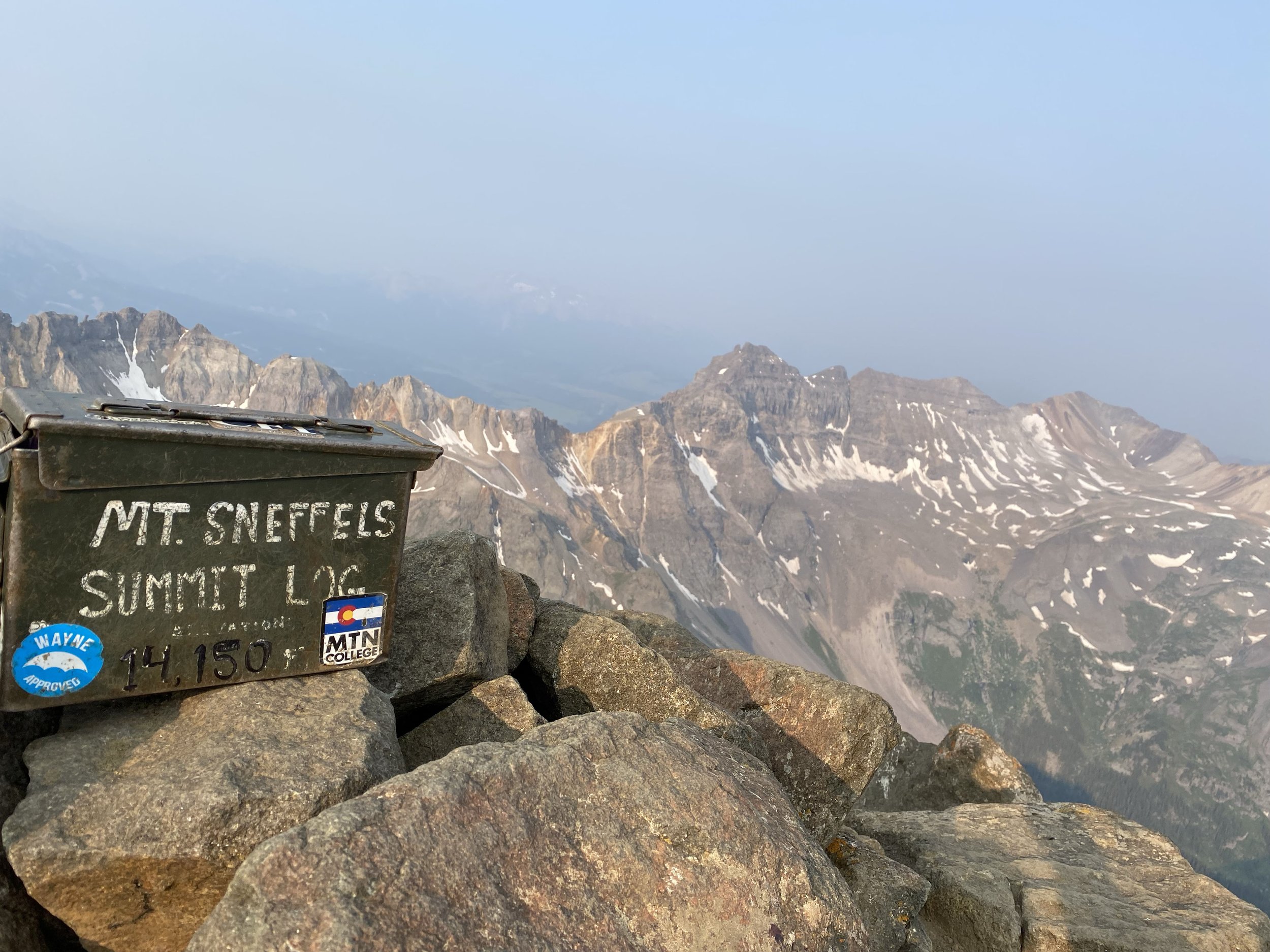
Mount Sneffels
-
This is our closest 14er. Sneffels is the 4th highest of the peaks in Colorado! The ascent takes you up a large boulder field. Please be careful and their could be hikers below you and you don’t want a rock to start rolling. Once you get up the boulder field, you are in the saddle. The trail takes off to your left up another crevice that is smaller boulders.
Once you get to the top, enjoy the 360 views. But, take note of the weather, your location, and the way back.
-
5.4 Miles from Yankee Boy Basin
3.5 Miles from Wright’s Lake
2.1 Miles from top trailhead
-
6-9 Hours
-
Very Difficult
-
We don’t recommend you take your pets here.
Do you Have Everything For Hiking?
Check out our “Hiking Essentials” List
Water - 2 Bottles Minimum
Snacks - Energy bars, trail mix, etc
Pocket Knife
Insect Repellant
Sunscreen
Whistle
Maps of the Area - Available at local shops
Compass
Toilet Paper/ Wag Bag (pack out what you pack in)
Rain Gear
Headlamp
Hat
Gloves
Warm Jacket
Cell Phone (chance of working is only 70%)
Sunglasses
Bear Spray
Hiking Poles
For safety
Blanket, Flashlight, Poncho, First Aid Kit, Moleskin, Bandage, Antihistamine, Tylenol, and your Identification.
If you have space, it is always good to bring layers of clothing, the COSAR Card, and extra shirt and socks.
Safety check-list
Navigation - Compass, wrist altimeter, GPS, topographic map
Sun Protection - Sunglasses, sunscreen, clothing
Insulation - Additional layers of clothing
Illumination - Headlamps, flashlights, packable lanterns
First-aid - First-aid kits
Fire - Matches, firestarter
Repair kit & tools - Knives, multi-tools, repair kit, duct tape
Nutrition - Food
Hydration - WATER, more water, and extra water, filter/ purifier, or chemical treatment
Emergency Shelter - Shelter

Hiking during
hunting season
Wear Hunter Safety orange. Lots of it! It is best to wear a minimum of 500 square inches above the waist of solid blaze orange, which entails a minimum of an orange vest and an orange cap.
Know before you go. Know your location and the surrounding areas. Know which hunting season it is.
As with any season, if you are going alone, let someone know where you are going and when you plan to be back.
Realize that muzzleloader, archery and other non-rifle seasons are going to be much less heavily hunted. Rifle season is the biggest worry.
Make sure your dog is also wearing some sort of orange. The same style hunter's vest that you wear will also work on your dog if you can't find a canine- specific cape. Put his legs through the armholes, bring the front panels under his
belly and pin together on top. Criss-crossing under the belly helps with keeping it in place. Bandanas are also good, and it doesn't hurt to have an orange bandana for signaling any time of the yearDon't wear gray, tan, brown or white -you don't want to be mistaken for a deer.
Make noise- sing, talk, whistle-make sure people know you're coming through. You can tie a bell to your dog's collar as well. This is also good in bear country the rest of the year. If you see a hunter, call out your location.
If you encounter outfitters and hunters on horseback give them the right of way. Yield to horseback riders by stepping off on the downhill side of the trail. Move slowly and speak in a normal tone of voice so you won't spook the horses.
Explore National Parks such as Mesa Verde and Canyonlands. These areas are off-limits to hunting.
Remember to stay on designated trails and roads, and always practice Leave No Trace principles.
Hiking Facts & Hints
Moderate hiking with stops for rests and taking in scenery, uphill, covers approximately 1000 vertical feet an hour. Downhill is usually about 1300 feet.
Average distance covered in moderate hiking is about 1 to 1.5 miles uphill and 2 miles downhill.
The tree line varies between 11,200 feet and 11,800 feet. Average is about 11,500 feet.
Above tree line is tundra, patches of scrub willow and rocks and cliffs with scree and talus.
At the first sound of thunder, all parties should descend below tree line. Do not shelter under a solitary tree. If caught above tree line, when lightening strikes, try to find an indentation in the ground or hide under a rock. Detach yourself from your pack and anything metal. Crouch on all fours.
Wild flowers start in May but the finest displays are from mid July to mid August. The best elevation for wild flowers is between 11,800 feet and 12,500 feet.
The "monsoon" can run from early July to the end of August. Generally this can involve moderate to heavy rain after about 2pm.
Temperature falls about 3 degrees for every one thousand feet. Example: 75 degrees in Ouray at 7,600 feet becomes 58 degrees at 12,800 feet. If Ouray's temperature falls to 60 degrees, it can be 42 degrees on the top of Sneffels. This is without wind-chill factor. If there is a 35MPH wind on the top of Sneffels or any highline ridge, the effect can be well below freezing.
Any hiking outing, especially with one individual, should involve leaving details of timings and hike destination with another party.
All hikers doing more serious hikes should purchase a mountain rescue safety card from Ouray Mountain Sports or other outlets.
11. The best "big picture" map is the Drake Mountain Map of Silverton, Telluride and Ouray. The best local map is the Hiking Trails of Ouray County put out by the Ouray Trails Group. For specific detail the best smaller scale maps are the USGS topographical series. The most used quadrants for our hiking are: Ouray, Ironton, Mt Sneffels, Telluride, Ophir, Handies Peak and Silverton.
12. The water on trails is not suitable for drinking. Several of the most popular trails have no water at all on them. (Think of dogs!)
13. Many trails can be very slippery, especially if footwear is not adequate.
14. Cell phones often do not work, even on the top of ridges and mountains.
15. Always carry adequate clothing, good footwear, sunscreen, insect repellant, energy bars, water.
16. Many trails pass through private property. Please be responsible. Pick up trash. Do not haul out mining remains. Respect owner's rights. There will probably be no "private" signs.
17. Best advice is to start early. It is cooler, the light is better and you will be off the top before weather deteriorates.
18. If doing anything other than one of the most used trails, take map(s) and trail guide. This will help avoid getting lost and wasting time!
19. Do not "use bathroom" close to water source.
20. If in a group, keep together. Communicate. Watch for signs of altitude sickness. Descend
immediately if you notice hypothermia, irritability, nausea, spots before the eyes or other abnormal
signs of weakness. Drink plenty.
Ouray Trail Group
The Ouray Trail Group, a local non-profit, in conjunction with the U.S. Forest Service, has developed and maintains over 76 spectacular hiking trails in the area. The region provides trails for all experience levels, ranging from easy, shorter hikes to longer and more challenging ones. The Hiking Trails of Ouray County, a customized area topographical map and guide, is an excellent source for detailed information regarding the difficulty level, attractions, hazards and location of the trailhead for each of our area hikes. This map is issued by OTG and may be purchased in some of the local shops or at the Visitor Center for $13.

Trail Etiquette
Ouray trails are as varied as they are vast. They often lead to the tops of peaks, where an entire panorama of mountains sits at your feet, but remember to always be prepared by bringing along adequate supplies and letting others know where you are going and when you expect to return. Below are some trail etiquette rules and a checklist of what to take on your journey into the high country.
Hike with at least one partner
Pack it in, pack it out
Don't pick wildflowers or disturb historic sites
Honor posted signs and do not trespass
Check daily conditions
Do not disturb wildlife
Stay on trails to avoid erosion
Mountain bikers yield to hikers and horses; all users yield to horses
Avoid hiking or riding in muddy conditions
Riders and hikers traveling downhill yield to those traveling uphill
Trail users should travel single file
If you use earphones, keep the volume low to hear potential threats or other travelers along the trail
Make sure children know what to do if separated (hug a tree & stay put)
Pick up after your dog and obey leash laws
Call 911 in case of emergency (Ouray Mountain Rescue, under the direction of the Ouray County Sheriff's Office, is always on call for assistance.)
Remember to protect these trails: “Take only pictures, and leave only footprints."
Checklist and Precautions for Day Hikers
Hydration (water, water treatment device)
Food (two-days worth: salty & calorie dense)
Layers of insulation (jacket, gloves, hat)
Sun protection (sunglasses, sunscreen, hat)
Light (flashlight, headlamp)
Camera & cell phone
Navigation device (map, GPS, compass)
Fire (lighter, waterproof matches, fire starter)
First aid kit (first aid supplies, knife, duct tape, pepper spray)
Emergency shelter (reflective blanket, tarp, tent)
Walking/trekking poles
It is always a wise choice to check on trail conditions before heading out into the high country. A detailed list describing local trails and current conditions can be found at the Ouray Trail Group website.
Please allow yourself to become acclimated to the elevation before taking strenuous hiking trips. Jogging or walking at lower elevations prior to coming to Ouray, or just starting out here, with the Perimeter Trail, will help significantly.
Give yourself and your travel group peace of mind by purchasing a Search & Rescue Card. For only $3.00 a year or $12.00 for five years, you are covered by the Colorado Outdoor Recreation Search and Rescue Fund (COSAR). This fund reimburses counties for large costs associated with backcountry rescues such as helicopter air lifts. These cards are available at Ouray Mountain Sports.
Encounters with Wildlife Guidelines
While it is rare to encounter a black bear or mountain lion along a trail, we do share the alpine environment with them. Never approach, startle, or feed any wild animal, especially a bear or lion with young. If you encounter a bear: stay calm, back away, and speak softly. Step off the trail and allow the bear to leave.
If you encounter a lion: make yourself look larger by raising your arms or opening up your jacket. Never turn your back and run. Pick up small children to keep them from running.